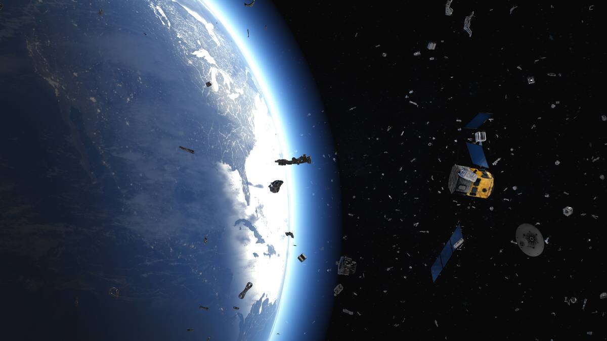
 The growing number of debris in space puts satellites at risk.
ALEXANDRIA – Not all networks are created equal. Most networks don’t run the risk of collisions with high-speed meteorites or pieces of junk, for example. Space networks exemplify a very different playing field, however.
Last week’s news of the Intelsat-33e communications satellite catastrophic failure and breakup yet again spurred conversation around the vital need for space situational awareness.
The event, which began with a power outage shortly before the final signal transmission, has created 500 pieces of debris in GEO, according to ExoAnalytic Solutions. The reason for the satellite’s failure remains a mystery.
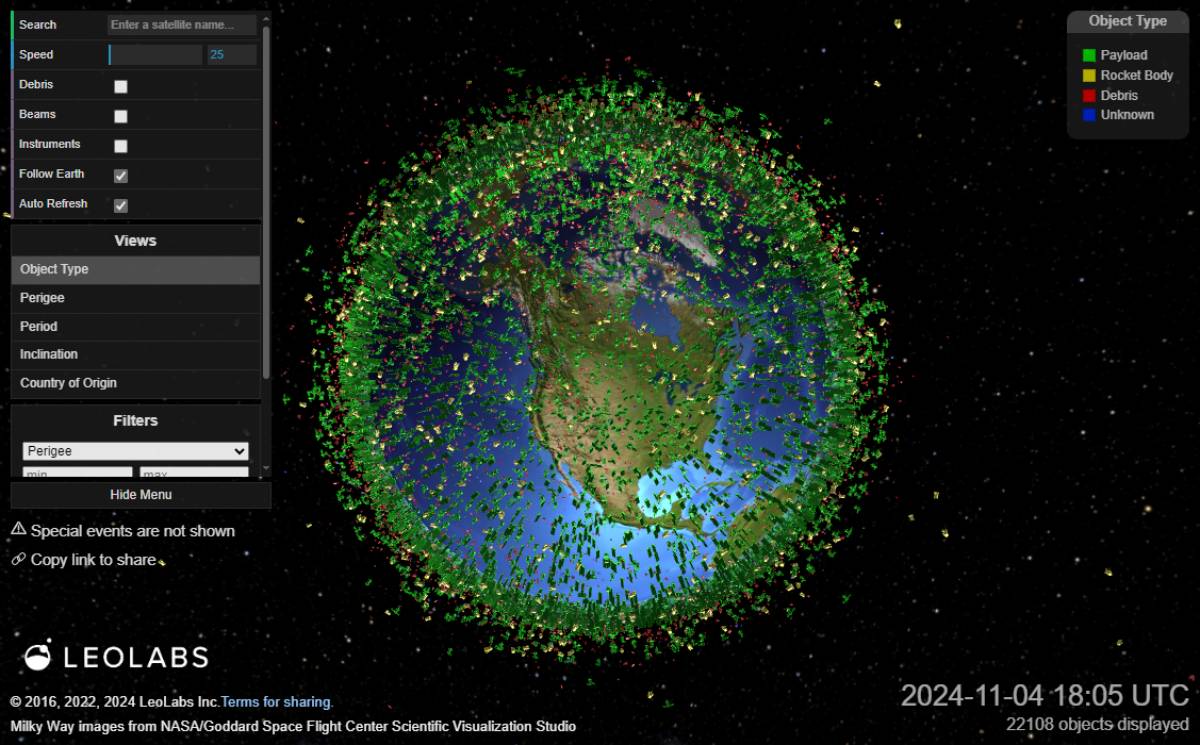
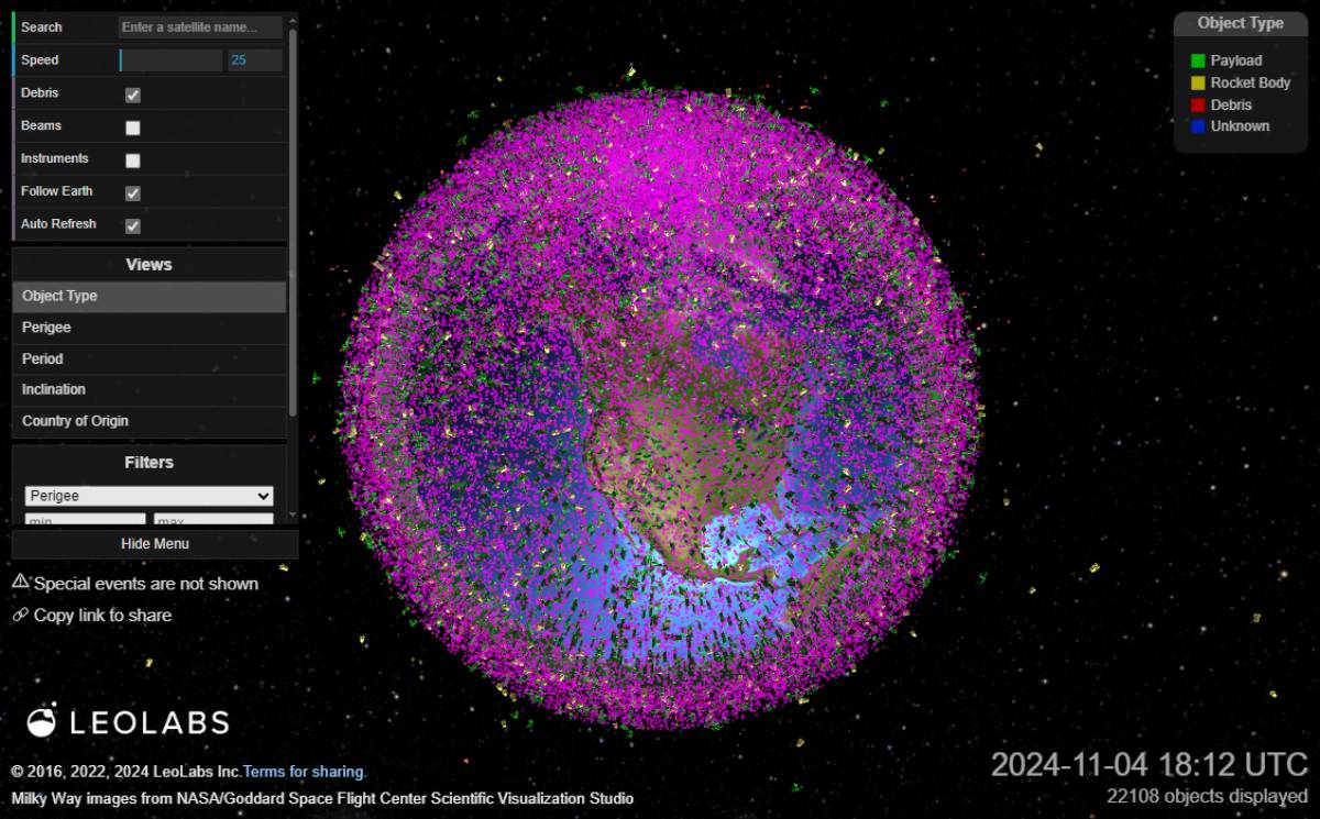
The space environment being “congested and contested” has almost become a cliché term among industry folks. Nonetheless, the statement stands true, with more than 13,000 tons of space objects in Earth’s orbit. Of those, the European Space Agency’s Space Debris Office calculates:
- 40,500 debris objects greater than 10 cm
- 1,100,000 debris objects 1-10 cm in size
- 130 million debris objects 1mm-1cm in size
Intelsat’s satellite failure is not the first of its kind. For example, 2017 was notable for seeing multiple unexplained GEO satellite failures and breakups--SES AMC-9, Echostar-3, SES NSS-806 and Telkom-1—all of which disrupted client services.
“What I’ve found over the last 40 years is whatever is a cool thing to talk about, they’ll blame all the failures on,” Darren McKnight, Senior Technical Fellow at LeoLabs, told Constellations in an interview. From space weather to cyberattacks to space debris, finger-pointing trends have shifted. And while debris is a growing concern in some orbits, it’s becoming better in others.
 LeoLabs’ Low Earth Orbit Visualization shows tracked on-orbit activities. (Source: LeoLabs)
 LeoLabs’ Low Earth Orbit Visualization showcases the vast amount of debris in orbit. (Source: LeoLabs)
In LEO, for example, fragments below approximately 650 kilometers will wash out in about a year, McKnight explained. Intact objects, however, will be able to withstand the effects of atmospheric drag, therefore staying in-orbit much longer; over 25 years starting at 650 km. Meanwhile, GEO offers much more persistence and complexity and much less predictability.
Debris size matters, but it depends
“There are a lot of schools of thought right now that millimeter size particles are going to cause mission-degrading impacts,” McKnight said, specifically speaking to anomalies within LEO. Most companies work to shield their spacecrafts from particles of 5 mm and below, he explained.
Upon examining 27 anomalies in LEO over the last 20 years, McKnight found that centimeter size objects correlated much better with reported mission degrading events, than millimeter sized objects. While others may disagree, he says, “we don’t see the evidence of millimeter-sized debris having a measurable effect on space operations right now.”
“I think that we’d have a lot more anomalies if we were susceptible to 1mm,” he continued. The smallest thing that can be seen in LEO is about 10 cm in size, McKnight stated. “My hypothesis is that 1-10 cm is definitely lethal and non-trackable,” also known as LNT debris.
GEO, on the other hand, sees a larger flux from meteoroids than debris. So says Roohi Dalal, who recently joined the American Astronomical Society as Deputy Director of Public Policy. Dalal gave a presentation on NC3 satellites impacted by debris at this year’s annual AMOS conference on behalf of her team of co-authors from the Outer Space Institute, University of British Columbia.
“Those meteoroids tend to be a lot smaller than debris, but they have very high velocities … generally around 20 kilometers per second” she told Constellations. They therefore have the potential to be lethal and nontrackable, according to Dalal.
Altitudes & attitudes
Anomaly attribution often means asking ‘why?’ several times, because more often than not, human error is to blame, McKnight said. This is where anomaly preparedness comes in.
The number one thing in anomaly planning is not aiming for 99% reliability, he suggested. Instead, “go for 95% reliability and the ability to deal with anomalies … plan, exercise, train.”
Dalal’s research for GEO anomalies additionally suggests further investments in observational follow up to attribute the cause of satellite failures in a matter of hours as opposed to days. “Let’s say we assume that if debris hit a satellite, it would lose its ability to maintain its [attitude],” she said. Past satellite failures have been seen tumbling due to a collision, Dalal explained. One follow-up method to quickly detect changes in the satellite attitude, i.e. its inclination with respect to the orbital place, could be satellite laser ranging, which uses cubed corner retroreflectors pre-equipped on satellites,
“From the Earth, you send a series of laser pulses that get reflected off the satellite and come back to your ground station … and if the satellite orientation changed, because now it’s not angled directly at your ground station, it’s tilted away from it, you’d see a reduction in how many photons you’re getting back when you send those laser pulses off the satellite.” Though this strategy is most commonly used to determine the orientation change of a satellite, it could be useful in anomaly attribution as well.
The second suggested method Dalal offered was inverse synthetic aperture radar imaging.
“The idea is basically that you’re taking radar images and generating a high-resolution two-dimensional image of an object.” If the object has tilted away or started tumbling, she explained, the 2D images would be de-focused due to changes in attitude. This method does not require pre-installment of equipment, she added. Of note, both methods can be done any time of day.
Active debris removal – friend or foe?
While the discussions about active debris removal have grown exponentially in recent years, there is still no policy or regulation mandating it. Beside economic hurdles, one of the reasons for that comes down to safety and security risks of dual-purpose satellites.
“If you’re a satellite that’s built to do close approaches, whether it’s for active debris removal or on-orbit servicing or manufacturing in-orbit … that could be used for civil or commercial sensing or it could be used in a security sensitive capability,” Victoria Samson explained. Samson currently serves as the Chief Director for Space Security and Stability for the Secure World Foundation.
According to the Global Counterspace Capabilities report, co-orbital capabilities are a possible counterspace capability. The systems, which get launched into space, could interfere with other space systems, whether using a laser to blind or jam or take pictures or release objects at high velocity.
“When we talk about active debris removal, we use examples of government entities having demonstrated rendezvous proximity operations capabilities because this could potentially be a counterspace capability,” Samson added. This could mean that uncoordinated close approaches may pose serious threats to national security.
Two years ago, for example, China had a debris-shedding satellite in GEO. “They sent another satellite up there to grab it and move it to the graveyard orbit.”
Response to such news is highly dependent on perspective, Samson explained. “You could say, ‘China was being a responsible space actor,’” by removing a satellite which was creating a lot of debris in a highly valuable orbit, following best practices and promoting sustainability.
“Others will say, ‘China has demonstrated an on-orbit ability to interfere with other countries’ satellites because they have done active removal, therefore they have demonstrated an offensive counterspace capability.’”
Explore more:
Collision Avoidance Services, Transparency in Dual Use Technology and Space Domain Awareness
Falling Debris and Near-Miss Collisions: Mitigating Risk in LEO
Astroscale Poised for $450M Revenue With Satellite Debris Removal and Life-Extension Services
